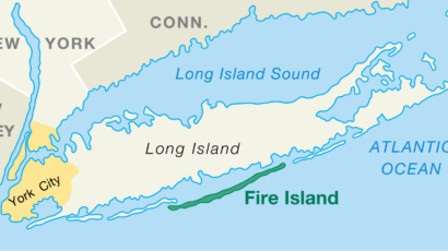
Fire Island is a 32-mile barrier island off the south shore of Long Island. It runs from Moriches Inlet in the east to Democrat Point on the west and measures 0.5 miles at its widest point. It is home to 17 different communities which fall within the boundaries of Fire Island National Seashore.
Ferry services, connecting Patchogue, Bay Shore and Sayville to 10 points on the island, offer access to the resort communities.
For more information:
wikipedia.org/wiki/Fire_Island
Davis Park is the easternmost of the Fire Island residential communities, boasting a stunning beach and bay with miles of dunes and the Otis Pike Wilderness Area as its borders.
The community extends along 3/4 of a mile of beachfront, ranging from 330 yards at its widest point to 190 yards wide at its narrowest. Davis Park is surrounded by vast wilderness areas on both sides.
The origins of Davis Park can be traced back to the 1940s, when Mr. Davis from Blue Point owned a tract of land on Fire Island and left it to his sons upon passing away. One of these sons then sold their share to four friends–Lee Coffin, Ed Shembler, Joe Gerard, and Al Brown–which would go on to become Leja Beach, a beachfront named after the first initials of all four founders.
Davis Park is commonly used to refer to three contiguous areas in the hamlet of Davis Park, namely, Davis Park, Leja Beach, and Ocean Ridge. Leja Beach is to the west of Trustees Walk and Ocean Ridge is to the east. There are approximately 270 seasonal homes within Davis Park.
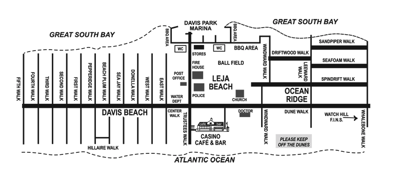
There is one unpaved road, known as the Burma Road. You get around walking on the boardwalks, or along the ocean. Except for emergency, utility, and construction vehicles, there are no cars, bikes, or scooters allowed.
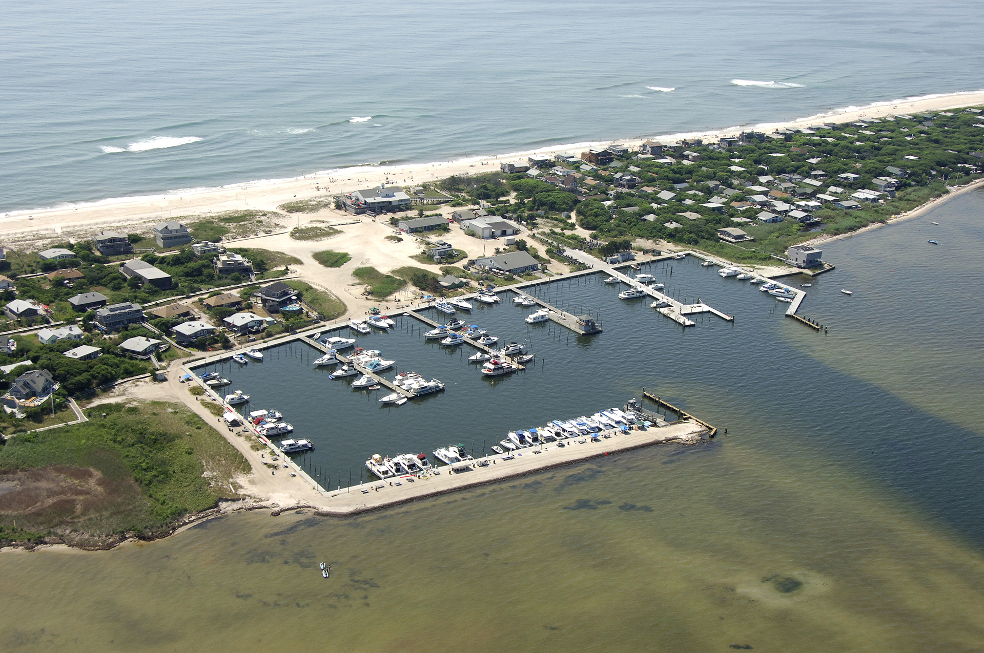
Davis Park has one of Fire Island’s largest marinas, which can accommodate up to 250 boats.
A lifeguarded section of beach is also available, as are public restrooms and showers.
You can find a number of community activities throughout the year such as the annual Arts & Crafts fair and 4th of July parade.
For more information:
wikipedia.org/wiki/Davis_Park,_New_York


Ferry
Davis Park can only be reached by boat. The Davis Park Ferry operates from Sandspit Park in Patchogue from mid-March to the end of November. The ferry ride takes about 15-20 minutes.
Schedule and Rates:
www.davisparkferry.com
Taking the Train
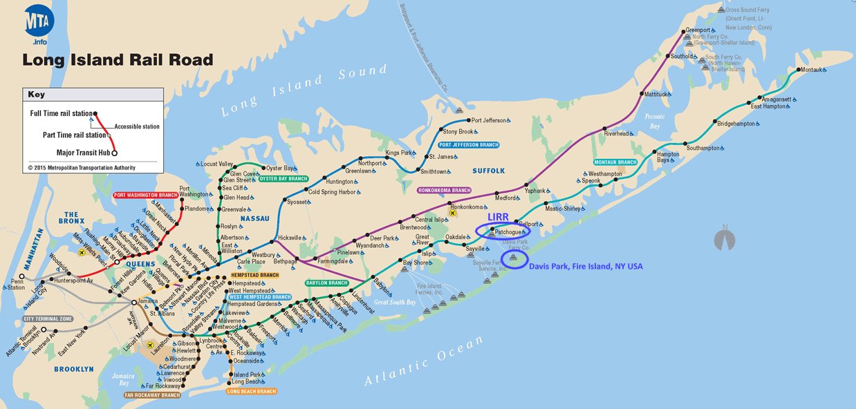
You can take the LIRR to Patchogue station. It’s about a 1 hour and 45 minute ride from NYC. The station is 1 mile to the ferry. You can find some taxis there, and Uber and Lyft are also available.
Schedule and Fares:
http://lirr42.mta.info
View Map